Get Land Surveying in Rockville, MD
Land surveying services for Rockville, MD help property owners resolve boundary disputes, plan construction projects, and accurately define lot lines with experienced local contractors.
Property owners in Rockville, MD often turn to land surveying services when planning new construction, property boundary adjustments, or development projects. Accurate land surveys provide essential information to ensure that property boundaries are clearly defined and that any improvements or modifications comply with local regulations. Exploring options from nearby service providers can help property owners find the right expertise to support their planning needs and avoid potential issues during project implementation.
Whether updating property lines, preparing for renovations, or assessing land features, connecting with experienced local contractors can make the process smoother and more reliable. Comparing services from qualified professionals in the area allows property owners to gather detailed insights and select the best fit for their specific project requirements. Continuing to explore available options can help ensure that planning efforts are well-informed and aligned with local standards.
- Boundary Surveys - needed when establishing property lines for new fences or land division in neighborhoods around Rockville, MD.
- Construction Site Surveys - required before starting new developments or building projects in areas like North Bethesda or Gaithersburg.
- Topographic Surveys - used to assess land features for grading, drainage, or landscaping in suburban communities near Rockville.
- ALTA/NSPS Land Title Surveys - essential for commercial property transactions or developments in commercial districts of Montgomery County.
- Subdivision Surveys - necessary when dividing larger parcels into smaller lots for residential or commercial use in the local area.
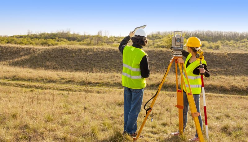

Land surveying services involve the precise measurement and mapping of property boundaries, topography, and features. These services typically include establishing property lines, creating detailed maps, and providing accurate data that define the physical characteristics of a parcel of land. Land surveyors use specialized tools and techniques to gather measurements, ensuring that the information is accurate and reliable. This process is essential for homeowners planning construction projects, property divisions, or boundary disputes, as it provides a clear understanding of the land’s layout and legal boundaries.
One of the primary problems land surveying helps solve is boundary clarification. When property lines are unclear or disputed, a professional survey can establish definitive borders, preventing future conflicts with neighbors. It also assists in identifying easements, encroachments, or existing structures that may impact a property’s use or development. For homeowners considering additions, fences, or new construction, having an accurate survey ensures that improvements are within legal boundaries and conform to local regulations. This service can also be crucial during property transactions, providing buyers and sellers with confidence in the land’s boundaries and features.
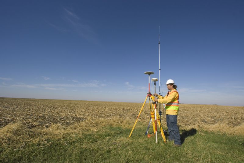
Land surveying services are commonly used for residential, commercial, and agricultural properties. Homeowners in Rockville, MD, and surrounding areas often seek surveys when planning to build a new garage, extend a driveway, or install fencing. Property developers and builders rely on surveys to ensure their projects are accurately positioned on the land. Agricultural landowners may also use surveying services for boundary delineation or planning irrigation systems. Regardless of the property type, a professional survey provides the detailed information needed to make informed decisions about land use and development.
By working with experienced local contractors, homeowners and property owners can ensure their land-related projects are based on precise measurements and clear boundaries. Whether resolving boundary disputes, planning new construction, or simply confirming property lines, land surveying services offer valuable insights that help prevent future issues. Contacting qualified service providers in the area can provide the expertise needed to navigate land-related challenges effectively, making it easier to move forward with confidence in any property-related project.
The overview below groups typical Land Surveying projects into broad ranges so you can see how smaller, mid-sized, and larger jobs often compare in Rockville, MD.
In many markets, a large share of routine jobs stays in the lower and middle ranges, while only a smaller percentage of projects moves into the highest bands when the work is more complex or site conditions are harder than average.
Smaller Land Surveys - Many routine boundary or topographic surveys for residential properties in Rockville typically range from $250 to $600. These jobs usually involve straightforward measurements and are completed within a few hours or days. Most local contractors handle projects within this cost band.
Mid-Size Projects - Larger lot surveys or more detailed site assessments generally cost between $600 and $1,500. These projects may include multiple property corners or additional data collection and are common for homeowners planning additions or land divisions.
Complex or Custom Surveys - Highly detailed surveys, such as for commercial developments or irregularly shaped parcels, can range from $1,500 to $3,500. These projects often require advanced equipment and longer fieldwork, with fewer jobs falling into this higher price range.
Full Land Replacements or Large-Scale Projects - Extensive surveys for large properties or full site reconstructions can cost $3,500 and above, with larger, more complex projects reaching $5,000+ in some cases. Such jobs are less common and involve comprehensive data collection and analysis by specialized local service providers.
Actual totals will depend on details like access to the work area, the scope of the project, and the materials selected, so use these as general starting points rather than exact figures.
Construction Planning - Land surveyors provide precise measurements and boundary data essential for planning residential, commercial, or infrastructure projects in Rockville, MD.
Boundary Disputes Resolution - Local contractors use surveying skills to establish property lines and resolve boundary conflicts for homeowners and property managers.
Topographic Mapping - Surveying services create detailed terrain maps that assist in site development, drainage planning, and environmental assessments.
Subdivision Design - Land surveyors help with dividing larger parcels into smaller lots, ensuring compliance with local zoning and planning regulations.
Utility Location Services - Accurate positioning of underground utilities relies on surveying techniques to prevent conflicts during construction or maintenance.
Easement and Right-of-Way Surveys - Surveyors identify and document access rights and easements critical for infrastructure projects and property development.

When comparing land surveying service providers in the Rockville, MD area, it’s important to consider their experience with projects similar to what’s needed. Homeowners should look for local contractors who have a track record of handling residential or property boundary surveys in the neighborhood. Experience with comparable projects can provide insight into a provider’s familiarity with local regulations, terrain, and property types, helping to ensure the work is performed accurately and efficiently.
Clear, written expectations are essential when evaluating potential land surveyors. Homeowners should seek service providers who offer detailed descriptions of their scope of work, deliverables, and any assumptions or limitations. Having this information in writing helps prevent misunderstandings and provides a reference point throughout the project. It’s also beneficial to ask for reputable references from past clients to verify the quality of work and professionalism, ensuring the provider’s reputation aligns with the homeowner’s needs.
Effective communication plays a key role in a successful land surveying project. Homeowners should prioritize local contractors who are responsive, transparent, and willing to answer questions thoroughly. Good communication helps clarify project details, timelines, and any concerns that may arise. While the site introduces homeowners to local options, it’s important to remember that it does not perform the work itself. Instead, it serves as a resource for connecting with service providers who can handle the job, making it easier to compare options based on experience, clarity, and communication style.
Property owners in Rockville, MD use Land Surveying services for practical projects around their homes and businesses. This guide focuses on everyday jobs and straightforward project options.

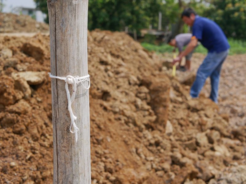
Land surveying services are often needed for a variety of everyday property projects in Rockville, MD. Property owners might seek these services when planning to build a new addition, install a fence, or subdivide a lot. Accurate property boundaries are essential for avoiding disputes with neighbors and ensuring that any construction or landscaping work complies with local regulations. Local contractors can provide detailed measurements and boundary assessments to help property owners move forward confidently with their projects.
Additionally, property owners may look for land surveying assistance when dealing with property line disputes or clarifying existing boundaries. These services can also be useful before purchasing a property to confirm its exact size and boundaries. Whether updating property records or preparing for future development, local surveyors are equipped to handle the common needs of property owners in Rockville, MD, ensuring their projects are based on precise and reliable property information.
What is land surveying? Land surveying involves measuring and mapping land boundaries, features, and elevations to provide accurate property information for various projects in Rockville, MD and nearby areas.
Why is land surveying important before construction? Land surveying ensures that property lines are correctly identified, helping prevent disputes and providing precise data needed for building and development projects.
What types of land surveying services are available? Local contractors offer a range of services including boundary surveys, topographic surveys, subdivision surveys, and site planning assistance.
How do land surveys support property transactions? Accurate land surveys provide clear property boundaries and details, helping buyers, sellers, and lenders make informed decisions during transactions.
What should I consider when choosing a land surveying service? Consider the experience of local service providers, their familiarity with the area, and their ability to deliver precise and reliable survey reports for your project needs.
Property Boundary Clarification - Local contractors can provide precise surveys to clearly define property lines, helping avoid disputes with neighbors.
Building Permit Support - Land surveying services assist property owners in preparing accurate site plans required for building permits.
Land Development Planning - Surveyors can help outline property features to support planning for renovations, additions, or new construction projects.
Subdivision and Lot Division - Service providers can facilitate dividing larger parcels into smaller lots for sale or development purposes.
If you are thinking about Land Surveying for a property in Rockville, MD, this guide is meant to help you understand the work, the typical project types, and how different options might fit your plans.
When you are ready, you can use the quote form on this page to share a few details about your project. From there, local pros can review the basics and respond with options that match what you have in mind.